
Carte topographique Cabangan
Cliquez sur la carte pour afficher l’altitude.
Cabangan
The municipality has a varied topography characterized by high mountains to narrow coastal plains. The most outstanding feature observable in the municipality is the Zambales Range.
À propos de cette carte
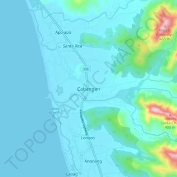
Nom : Carte topographique Cabangan, altitude, relief.
Lieu : Cabangan, Zambales, Central Luzon, 2203, Philippines (15.11895 120.01546 15.19895 120.09546)
Altitude moyenne : 52 m
Altitude minimum : -1 m
Altitude maximum : 495 m
Autres cartes topographiques
Cliquez sur une carte pour visualiser sa topographie, son altitude et son relief.