
Faire un don
Équipez-vous pour votre prochaine aventure :
En tant que Partenaire Amazon, ce site perçoit une commission sur les achats éligibles sans surcoût pour vous.
Carte topographique Nong Hoi
Cliquez sur la carte pour afficher l’altitude.
Faire un don
Équipez-vous pour votre prochaine aventure :
En tant que Partenaire Amazon, ce site perçoit une commission sur les achats éligibles sans surcoût pour vous.
À propos de cette carte
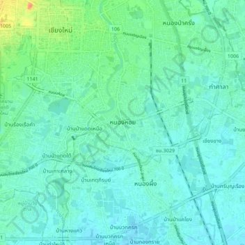
Nom : Carte topographique Nong Hoi, altitude, relief.
Altitude moyenne : 305 m
Altitude minimum : 297 m
Altitude maximum : 332 m
Faire un don
Équipez-vous pour votre prochaine aventure :
En tant que Partenaire Amazon, ce site perçoit une commission sur les achats éligibles sans surcoût pour vous.
Autres cartes topographiques
Cliquez sur une carte pour visualiser sa topographie, son altitude et son relief.
Chiang Mai City Municipality
The city is situated in a broad basin in the Thai highlands and lies at an average elevation of 300 m (1,000 ft) elevation above sea level. Chiang Mai's city centre sits west of the Ping River, a tributary to the Chao Phraya River. The city's sprawl extends outward in all directions, especially north, south,…
Altitude moyenne : 325 m
Chiang Mai City Municipality
The city is situated in a valley on a river basin in the Thai highlands and is on average at 300 m (1,000 ft) elevation. Chiang Mai's city centre sits west of the Ping River, a tributary to the Chao Phraya River, while the city's sprawl extends north-west, south-west, north-east and east of the river. To the…
Altitude moyenne : 325 m