
Carte topographique La Belinière
Carte interactive
Cliquez sur la carte pour afficher l’altitude.
À propos de cette carte
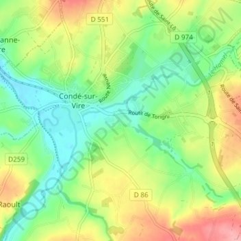
Nom : Carte topographique La Belinière, altitude, relief.
Altitude moyenne : 61 m
Altitude minimum : 20 m
Altitude maximum : 122 m
Autres cartes topographiques
Cliquez sur une carte pour visualiser sa topographie, son altitude et son relief.
Le Hamel
France > Normandie > Manche > Condé-sur-Vire > Les Carrières
Le Hamel, Les Carrières, Condé-sur-Vire, Saint-Lô, Manche, Normandie, France métropolitaine, 50890, France
Altitude moyenne : 51 m
Les Carrières
France > Normandie > Manche > Condé-sur-Vire
Les Carrières, Condé-sur-Vire, Saint-Lô, Manche, Normandie, France métropolitaine, 50890, France
Altitude moyenne : 61 m