
Faire un don
Équipez-vous pour votre prochaine aventure :
En tant que Partenaire Amazon, ce site perçoit une commission sur les achats éligibles sans surcoût pour vous.
Carte topographique Kelso
Cliquez sur la carte pour afficher l’altitude.
Faire un don
Équipez-vous pour votre prochaine aventure :
En tant que Partenaire Amazon, ce site perçoit une commission sur les achats éligibles sans surcoût pour vous.
À propos de cette carte
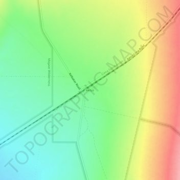
Nom : Carte topographique Kelso, altitude, relief.
Lieu : Kelso, San Bernardino County, California, United States (34.99176 -115.67154 35.03176 -115.63154)
Altitude moyenne : 660 m
Altitude minimum : 616 m
Altitude maximum : 720 m
Faire un don
Équipez-vous pour votre prochaine aventure :
En tant que Partenaire Amazon, ce site perçoit une commission sur les achats éligibles sans surcoût pour vous.
Autres cartes topographiques
Cliquez sur une carte pour visualiser sa topographie, son altitude et son relief.
Big Bear Lake
United States > California > San Bernardino County
Since 1970, Big Bear Lake has held an annual Oktoberfest. The Big Bear Lake Oktoberfest sports the highest beer garden, by elevation, in the United States. Big Bear Lake was incorporated as a city on November 28, 1980.
Altitude moyenne : 2.189 m
Chino Hills
United States > California > San Bernardino County
Due to its topography of rolling hills, Chino Hills was primarily rural prior to the mid-1970s; most land was utilized for equestrian purposes and for dairies, except for the multi-use purposes of the State of California, promoting jobs for the community through day labor from the Chino Institute for Men on…
Altitude moyenne : 255 m