
Carte topographique Rock Creek Park
Carte interactive
Cliquez sur la carte pour afficher l’altitude.
À propos de cette carte
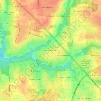
Nom : Carte topographique Rock Creek Park, altitude, relief.
Altitude moyenne : 91 m
Altitude minimum : 61 m
Altitude maximum : 110 m
Autres cartes topographiques
Cliquez sur une carte pour visualiser sa topographie, son altitude et son relief.
Sherwood Forest
United States > Alabama > Houston County > Dothan
Sherwood Forest, Dothan, Houston County, Alabama, 36303, United States
Altitude moyenne : 97 m
Dothan
United States > Alabama > Houston County > Dothan
Dothan, Houston County, Alabama, 36303-5834, United States
Altitude moyenne : 83 m