
Faire un don
Équipez-vous pour votre prochaine aventure :
En tant que Partenaire Amazon, ce site perçoit une commission sur les achats éligibles sans surcoût pour vous.
Carte topographique Gurla Mandhata
Cliquez sur la carte pour afficher l’altitude.
Faire un don
Équipez-vous pour votre prochaine aventure :
En tant que Partenaire Amazon, ce site perçoit une commission sur les achats éligibles sans surcoût pour vous.
Gurla Mandhata
In 1905, T. G. Longstaff made an attempt on the west face of Gurla Mandhata with two alpine guides and six porters. After suffering a 900 feet (270 m) fall during an avalanche, they turned back around 7,000 m (23,000 ft) upon finding fresh snow was falling too heavily to reach the summit with their provisions. This was a strong achievement for the time, especially for such a small group; at that time no summit of over 7,000 m had yet been climbed and Longstaff's height represented a world altitude record.
Faire un don
Équipez-vous pour votre prochaine aventure :
En tant que Partenaire Amazon, ce site perçoit une commission sur les achats éligibles sans surcoût pour vous.
À propos de cette carte
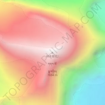
Nom : Carte topographique Gurla Mandhata, altitude, relief.
Altitude moyenne : 6.913 m
Altitude minimum : 5.852 m
Altitude maximum : 7.676 m
Faire un don
Équipez-vous pour votre prochaine aventure :
En tant que Partenaire Amazon, ce site perçoit une commission sur les achats éligibles sans surcoût pour vous.