
Carte topographique Prospect Village
Carte interactive
Cliquez sur la carte pour afficher l’altitude.
À propos de cette carte
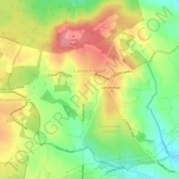
Nom : Carte topographique Prospect Village, altitude, relief.
Altitude moyenne : 192 m
Altitude minimum : 140 m
Altitude maximum : 244 m
Autres cartes topographiques
Cliquez sur une carte pour visualiser sa topographie, son altitude et son relief.
Rugeley
United Kingdom > England > Staffordshire > Cannock Chase
Rugeley, Cannock Chase, Staffordshire, England, United Kingdom
Altitude moyenne : 90 m
Cannock
United Kingdom > England > Staffordshire > Cannock Chase
Hednesford, Cannock, Cannock Chase, Staffordshire, England, United Kingdom
Altitude moyenne : 185 m