
Carte topographique Thaton District
Carte interactive
Cliquez sur la carte pour afficher l’altitude.
À propos de cette carte
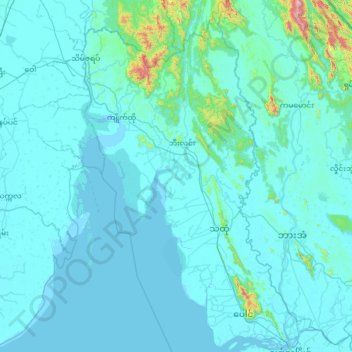
Nom : Carte topographique Thaton District, altitude, relief.
Lieu : Thaton District, Mon, 100, Myanmar (16.48466 96.86890 17.71763 97.64850)
Altitude moyenne : 55 m
Altitude minimum : -2 m
Altitude maximum : 1.350 m
Autres cartes topographiques
Cliquez sur une carte pour visualiser sa topographie, son altitude et son relief.
Paung Township
Myanmar > Mon > Paung Township
Paung Township, Thaton District, Mon, Myanmar
Altitude moyenne : 19 m