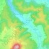
Carte topographique Reichenbach
Cliquez sur la carte pour afficher l’altitude.
À propos de cette carte

Nom : Carte topographique Reichenbach, altitude, relief.
Altitude moyenne : 333 m
Altitude minimum : 284 m
Altitude maximum : 412 m
Autres cartes topographiques
Cliquez sur une carte pour visualiser sa topographie, son altitude et son relief.
Eisenach
Germany > Thuringia > Wartburgkreis
Eisenach is at the northern edge of the Thuringian Forest, at an elevation of about 220 m. The terrain is hilly, and to the south also mountainous (up to 460 m of elevation), with the central Hörsel valley crossing the town in east–west direction. The Nesse river enters the Hörsel river in Eisenach after…
Altitude moyenne : 298 m
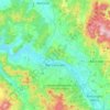
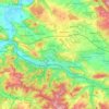
Eisenach
Germany > Thuringia > Wartburgkreis
Eisenach is situated at the northern edge of the Thuringian Forest, at an elevation of about 220 m. The terrain is hilly, to the south also mountainous (up to 460 m of elevation), with the central Hörsel valley crossing the town in east-western direction. The Nesse river enters the Hörsel river in Eisenach…
Altitude moyenne : 298 m
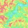
Eisenach
Germany > Thuringia > Wartburgkreis
Eisenach is at the northern edge of the Thuringian Forest, at an elevation of about 220 m. The terrain is hilly, and to the south also mountainous (up to 460 m of elevation), with the central Hörsel valley crossing the town in east–west direction. The Nesse river enters the Hörsel river in Eisenach after…
Altitude moyenne : 298 m