

Carte topographique Socorro
Cliquez sur la carte pour afficher l’altitude.
À propos de cette carte

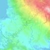
Nom : Carte topographique Socorro, altitude, relief.
Lieu : Socorro, Surigao del Norte, Caraga, 8416, Philippines (9.52136 125.81170 9.80515 126.05936)
Altitude moyenne : 15 m
Altitude minimum : 0 m
Altitude maximum : 260 m
Autres cartes topographiques
Cliquez sur une carte pour visualiser sa topographie, son altitude et son relief.
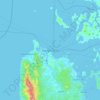
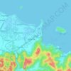
Surigao City
Philippines > Surigao Del Norte
Surigao City is marked by rolling hills that gently buffers its eastern and western boundaries. To the south-west towers the Kabangkaan Ridge which divides the city from the municipality of San Francisco (formerly Anao-aon). Kinabutan River (otherwise known as Surigao River) meanders Surigao valley before it…
Altitude moyenne : 40 m
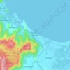
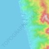
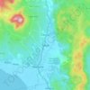








Mount Paco
Philippines > Surigao Del Norte > Paco
Paco is an inactive volcano, 524 metres (1,719 ft) in elevation, located at 9°35.6' North, 125°31.1' East, in the province of Surigao del Norte, region of Caraga, island of Mindanao, the Philippines.
Altitude moyenne : 386 m




Surigao City
Philippines > Surigao Del Norte
Surigao City is marked by rolling hills that gently buffers its eastern and western boundaries. To the south-west towers the Kabangkaan Ridge which divides the city from the municipality of San Francisco (formerly Anao-aon). Kinabutan River (otherwise known as Surigao River) meanders Surigao valley before it…
Altitude moyenne : 40 m

Surigao City
Philippines > Surigao Del Norte
Surigao City is marked by rolling hills that gently buffers its eastern and western boundaries. To the south-west towers the Kabangkaan Ridge which divides the city from the municipality of San Francisco (formerly Anao-aon). Kinabutan River (otherwise known as Surigao River) meanders Surigao valley before it…
Altitude moyenne : 40 m
Surigao City
Philippines > Surigao Del Norte
Surigao City is marked by rolling hills that gently buffers its eastern and western boundaries. To the south-west towers the Kabangkaan Ridge which divides the city from the municipality of San Francisco (formerly Anao-aon). Kinabutan River (otherwise known as Surigao River) meanders Surigao valley before it…
Altitude moyenne : 40 m