
Carte topographique Lalgola
Cliquez sur la carte pour afficher l’altitude.
Lalgola
Lalgola is located at 24°25′N 88°15′E / 24.42°N 88.25°E / 24.42; 88.25. It is located near the Padma River, which is the principal distributary of the Ganges, and which forms the border between India and Bangladesh in this area; thus Bangladesh bounds the town on the north and east. The average elevation is about 23 metres (75 ft)
À propos de cette carte
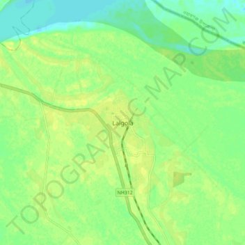
Nom : Carte topographique Lalgola, altitude, relief.
Lieu : Lalgola, Murshidabad, West Bengal, 742148, India (24.38048 88.21512 24.46048 88.29512)
Altitude moyenne : 22 m
Altitude minimum : 12 m
Altitude maximum : 28 m