
Carte topographique East Donyland
Carte interactive
Cliquez sur la carte pour afficher l’altitude.
À propos de cette carte
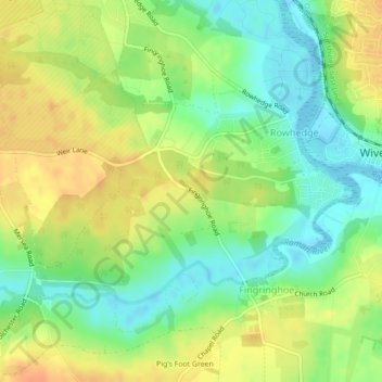
Nom : Carte topographique East Donyland, altitude, relief.
Altitude moyenne : 19 m
Altitude minimum : -1 m
Altitude maximum : 37 m
Autres cartes topographiques
Cliquez sur une carte pour visualiser sa topographie, son altitude et son relief.
Wakes Colne
United Kingdom > England > Colchester > Wakes Colne
Wakes Colne, Colchester, Essex, East of England, England, CO6 2DF, United Kingdom
Altitude moyenne : 51 m