
Carte topographique Plaxtol
Carte interactive
Cliquez sur la carte pour afficher l’altitude.
À propos de cette carte
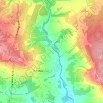
Nom : Carte topographique Plaxtol, altitude, relief.
Lieu : Plaxtol, Tonbridge and Malling, Kent, England, United Kingdom (51.24646 0.27757 51.28497 0.33605)
Altitude moyenne : 100 m
Altitude minimum : 36 m
Altitude maximum : 167 m