
Carte topographique Annan
Carte interactive
Cliquez sur la carte pour afficher l’altitude.
À propos de cette carte
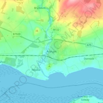
Nom : Carte topographique Annan, altitude, relief.
Altitude moyenne : 26 m
Altitude minimum : 0 m
Altitude maximum : 117 m
Autres cartes topographiques
Cliquez sur une carte pour visualiser sa topographie, son altitude et son relief.
Langholm
United Kingdom > Scotland > Dumfries and Galloway
Langholm, Dumfries and Galloway, Scotland, DG13 0JQ, United Kingdom
Altitude moyenne : 185 m
Manitou
United Kingdom > Scotland > Dumfries and Galloway
Manitou, Dumfries and Galloway, Scotland, United Kingdom
Altitude moyenne : 167 m
Gatehouse of Fleet
United Kingdom > Scotland > Dumfries and Galloway
Gatehouse of Fleet, Dumfries and Galloway, Scotland, DG7 2HR, United Kingdom
Altitude moyenne : 64 m