
Carte topographique Hofsós
Carte interactive
Cliquez sur la carte pour afficher l’altitude.
À propos de cette carte
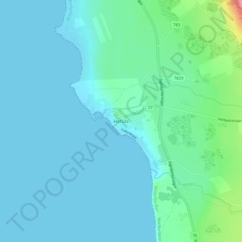
Nom : Carte topographique Hofsós, altitude, relief.
Lieu : Hofsós, Skagafjörður, Northwestern Region, 565, Iceland (65.87746 -19.43102 65.91746 -19.39102)
Altitude moyenne : 13 m
Altitude minimum : -1 m
Altitude maximum : 95 m