
Carte topographique Bois de Boulogne
Carte interactive
Cliquez sur la carte pour afficher l’altitude.
À propos de cette carte
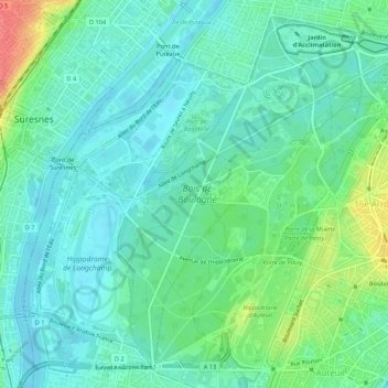
Nom : Carte topographique Bois de Boulogne, altitude, relief.
Altitude moyenne : 43 m
Altitude minimum : 26 m
Altitude maximum : 88 m
Varé bungled the assignment. He failed to take into account the difference in elevation between the beginning of the stream and the end; if his plan had been followed, the upper part of the stream would have been empty, and the lower portion flooded. When Haussmann saw the partially finished stream, he saw the problem immediately and had the elevations measured. He dismissed the unfortunate Varé and Hittorff, and designed the solution himself; an upper lake and a lower lake, divided by an elevated road, which serves as a dam, and a cascade which allows the water to flow between the lakes. This is the design still seen today.