
Faire un don
Équipez-vous pour votre prochaine aventure :
En tant que Partenaire Amazon, ce site perçoit une commission sur les achats éligibles sans surcoût pour vous.
Carte topographique Ultar Peak
Cliquez sur la carte pour afficher l’altitude.
Faire un don
Équipez-vous pour votre prochaine aventure :
En tant que Partenaire Amazon, ce site perçoit une commission sur les achats éligibles sans surcoût pour vous.
Ultar Peak
The first two summits were made in 1996 by two separate Japanese expeditions, the first on 11 July from the Tokai section of the Japanese Alpine Club led by Akito Yamazaki, and the second led by Ken Takahashi. The first summit team comprised Yamazaki and Kiyoshi Matsuoka (who died one year later on the nearby Ladyfinger Peak). They climbed the peak from the southwest in alpine style, doing much of the climbing at night to avoid danger from falling rock and ice. After their summit, they faced strong storms and bivouacked several days without food before returning to basecamp. Yamazaki died of high altitude sickness after the descent to basecamp. The second summit was made on 31 July via the south ridge by Takahashi, Masayuki Ando, Ryushi Hoshino, Wataru Saito, and Nobuo Tsutsumi.
Faire un don
Équipez-vous pour votre prochaine aventure :
En tant que Partenaire Amazon, ce site perçoit une commission sur les achats éligibles sans surcoût pour vous.
À propos de cette carte
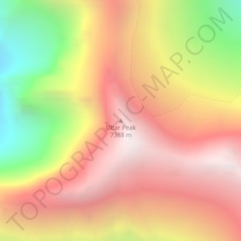
Nom : Carte topographique Ultar Peak, altitude, relief.
Altitude moyenne : 6.458 m
Altitude minimum : 5.199 m
Altitude maximum : 7.345 m
Faire un don
Équipez-vous pour votre prochaine aventure :
En tant que Partenaire Amazon, ce site perçoit une commission sur les achats éligibles sans surcoût pour vous.
Autres cartes topographiques
Cliquez sur une carte pour visualiser sa topographie, son altitude et son relief.