

Carte topographique Faridkot
Cliquez sur la carte pour afficher l’altitude.
Faridkot
The average elevation is 196 metres (643 ft). The town is located on the Punjab Plains, which in a macro regional context forms a part of greater Satluj Ganga plain. It is a low-lying flat area. The surface of the district is depositional plain which was formed by alleviation by the rivers flowing in these plains. Sirhind Feeder and Indira Gandhi Canal pass through the district. The topography of the district is plain, with only 1.4% of its area under forest cover.
À propos de cette carte
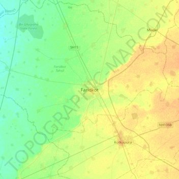
Nom : Carte topographique Faridkot, altitude, relief.
Lieu : Faridkot, Faridkot Tahsil, Faridkot, Punjab, 151200, India (30.51298 74.59170 30.83298 74.91170)
Altitude moyenne : 204 m
Altitude minimum : 193 m
Altitude maximum : 216 m