
Faire un don
Équipez-vous pour votre prochaine aventure :
En tant que Partenaire Amazon, ce site perçoit une commission sur les achats éligibles sans surcoût pour vous.
Carte topographique Mountain Grove
Cliquez sur la carte pour afficher l’altitude.
Faire un don
Équipez-vous pour votre prochaine aventure :
En tant que Partenaire Amazon, ce site perçoit une commission sur les achats éligibles sans surcoût pour vous.
Mountain Grove
This became known as the "mountain store, mountain grove or the mountain" due to its elevation of 1,525 feet (465 m). One of the most famous incidents in Mountain Grove occurred in the middle of May 1883, when what was called a "nipping frost" caused every tree, sapling and shrub in the community of Fyan and the Fyan depot to be cut clean as from an axe. Thus, the joining of Mountain Grove and adjoining Fyan occurred. In June, the name of the depot was changed to Mountain Grove. The town reapplied for a charter in 1886, changed its boundaries and held its first election.
Faire un don
Équipez-vous pour votre prochaine aventure :
En tant que Partenaire Amazon, ce site perçoit une commission sur les achats éligibles sans surcoût pour vous.
À propos de cette carte
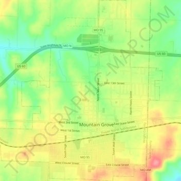
Nom : Carte topographique Mountain Grove, altitude, relief.
Lieu : Mountain Grove, Wright County, Missouri, United States (37.11790 -92.29495 37.15848 -92.24493)
Altitude moyenne : 444 m
Altitude minimum : 401 m
Altitude maximum : 488 m
Faire un don
Équipez-vous pour votre prochaine aventure :
En tant que Partenaire Amazon, ce site perçoit une commission sur les achats éligibles sans surcoût pour vous.