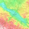
Carte topographique Innere Altstadt
Cliquez sur la carte pour afficher l’altitude.
Innere Altstadt
Dresden lies on both banks of the Elbe, mostly in the Dresden Basin, with the further reaches of the eastern Ore Mountains to the south, the steep slope of the Lusatian granitic crust to the north, and the Elbe Sandstone Mountains to the east at an altitude of about 113 metres (371 feet). Triebenberg is the highest point in Dresden at 384 metres (1,260 feet).
À propos de cette carte

Nom : Carte topographique Innere Altstadt, altitude, relief.
Lieu : Innere Altstadt, Altstadt, Dresden, Saxony, Germany (51.04626 13.73071 51.05593 13.74714)
Altitude moyenne : 117 m
Altitude minimum : 103 m
Altitude maximum : 137 m
Autres cartes topographiques
Cliquez sur une carte pour visualiser sa topographie, son altitude et son relief.