
Carte topographique Monte Cassino
Carte interactive
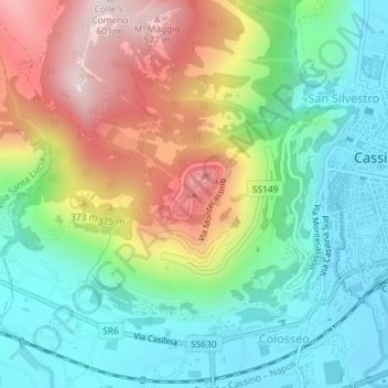
Cliquez sur la carte pour afficher l’altitude.
À propos de cette carte
Nom : Carte topographique Monte Cassino, altitude, relief.
Lieu : Monte Cassino, Cassino, Frosinone, Lazio, 03043, Italy (41.48990 13.81328 41.49000 13.81338)
Altitude moyenne : 231 m
Altitude minimum : 31 m
Altitude maximum : 583 m
Monte Cassino (today usually spelled Montecassino) is a rocky hill about 130 kilometres (80 mi) southeast of Rome, in the Latin Valley, Italy, 2 kilometres (1+1⁄4 mi) west of Cassino and at an elevation of 520 m (1,710 ft). Site of the Roman town of Casinum, it is widely known for its abbey, the first house of the Benedictine Order, having been established by Benedict of Nursia himself around 529. It was for the community of Monte Cassino that the Rule of Saint Benedict was composed.