
Faire un don
Équipez-vous pour votre prochaine aventure :
En tant que Partenaire Amazon, ce site perçoit une commission sur les achats éligibles sans surcoût pour vous.
Carte topographique Cape Hatteras
Cliquez sur la carte pour afficher l’altitude.
Faire un don
Équipez-vous pour votre prochaine aventure :
En tant que Partenaire Amazon, ce site perçoit une commission sur les achats éligibles sans surcoût pour vous.
Cape Hatteras
Long stretches of beach, sand dunes, marshes, and maritime forests create a unique environment where wind and waves shape the topography. A large area of the Outer Banks is part of a National Park, called the Cape Hatteras National Seashore. It is also the nearest landmass on the North American mainland to Bermuda, which is about 563 nautical miles (648 mi; 1,043 km) to the east-southeast.
Faire un don
Équipez-vous pour votre prochaine aventure :
En tant que Partenaire Amazon, ce site perçoit une commission sur les achats éligibles sans surcoût pour vous.
À propos de cette carte
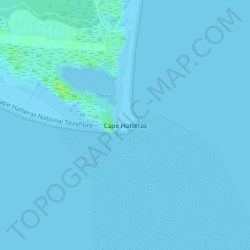
Nom : Carte topographique Cape Hatteras, altitude, relief.
Altitude moyenne : 1 m
Altitude minimum : -2 m
Altitude maximum : 9 m
Faire un don
Équipez-vous pour votre prochaine aventure :
En tant que Partenaire Amazon, ce site perçoit une commission sur les achats éligibles sans surcoût pour vous.
Autres cartes topographiques
Cliquez sur une carte pour visualiser sa topographie, son altitude et son relief.
Kill Devil Hills
United States > North Carolina > Dare County
First Flight Airport covers an area of 40 acres at an elevation of 13 feet (4 metres) above mean sea level. It has one runway; designated 2/20, with an asphalt surface measuring 3,000 by 60 feet (914 by 18 metres). For the 12-month period ending August 19, 2009, the airport had 38,120 aircraft operations, an…
Altitude moyenne : 2 m
Faire un don
Équipez-vous pour votre prochaine aventure :
En tant que Partenaire Amazon, ce site perçoit une commission sur les achats éligibles sans surcoût pour vous.
Cape Hatteras National Seashore
United States > North Carolina > Dare County > Nags Head
Altitude moyenne : 0 m
Faire un don
Équipez-vous pour votre prochaine aventure :
En tant que Partenaire Amazon, ce site perçoit une commission sur les achats éligibles sans surcoût pour vous.
Kill Devil Hills
United States > North Carolina > Dare County
First Flight Airport covers an area of 40 acres at an elevation of 13 feet (4 metres) above mean sea level. It has one runway; designated 3/21, with an asphalt surface measuring 3,000 by 60 feet (914 by 18 metres). For the 12-month period ending August 19, 2009, the airport had 38,120 aircraft operations, an…
Altitude moyenne : 2 m
Faire un don
Équipez-vous pour votre prochaine aventure :
En tant que Partenaire Amazon, ce site perçoit une commission sur les achats éligibles sans surcoût pour vous.
Kitty Hawk
United States > North Carolina > Dare County
Kitty Hawk is located at 36°06′N 75°42′W / 36.1°N 75.7°W / 36.1; -75.7 at an elevation of 7 feet (2 m) above sea level.
Altitude moyenne : 2 m
Faire un don
Équipez-vous pour votre prochaine aventure :
En tant que Partenaire Amazon, ce site perçoit une commission sur les achats éligibles sans surcoût pour vous.
Kill Devil Hills
United States > North Carolina > Dare County
First Flight Airport covers an area of 40 acres at an elevation of 13 feet (4 metres) above mean sea level. It has one runway; designated 2/20, with an asphalt surface measuring 3,000 by 60 feet (914 by 18 metres). For the 12-month period ending August 19, 2009, the airport had 38,120 aircraft operations, an…
Altitude moyenne : 2 m
Cape Hatteras National Seashore
United States > North Carolina > Dare County > Nags Head
Altitude moyenne : 0 m