
Carte topographique Long Drax
Cliquez sur la carte pour afficher l’altitude.
À propos de cette carte
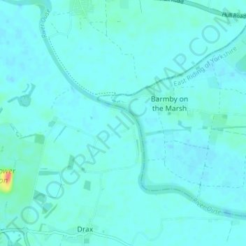
Nom : Carte topographique Long Drax, altitude, relief.
Lieu : Long Drax, North Yorkshire, England, United Kingdom (53.72722 -1.01916 53.76506 -0.96138)
Altitude moyenne : 5 m
Altitude minimum : -1 m
Altitude maximum : 43 m
Autres cartes topographiques
Cliquez sur une carte pour visualiser sa topographie, son altitude et son relief.
Scarborough
United Kingdom > England > North Yorkshire
The climate is temperate with mild summers and cool, windy, winters. The hottest months of the year are July and August, with temperatures reaching an average high of 17 °C and falling to 11 °C at night. The average daytime temperatures in January are 4 °C, falling to 1 °C at night. The station's elevation…
Altitude moyenne : 39 m
Bolton Castle
United Kingdom > England > North Yorkshire > Redmire > Castle Bolton
Altitude moyenne : 250 m
Thimbleby & Osmotherly Show field
United Kingdom > England > North Yorkshire > Thimbleby
Altitude moyenne : 152 m
Killinghall
United Kingdom > England > North Yorkshire > Harrogate > Killinghall
Altitude moyenne : 86 m
Arkle Town
United Kingdom > England > North Yorkshire > Richmondshire > Arkle Town
Altitude moyenne : 367 m
Swinithwaite
United Kingdom > England > North Yorkshire > Richmondshire > West Witton > Swinithwaite
Altitude moyenne : 205 m