
Carte topographique Cherry Hill
Carte interactive
Cliquez sur la carte pour afficher l’altitude.
À propos de cette carte
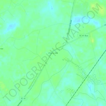
Nom : Carte topographique Cherry Hill, altitude, relief.
Altitude moyenne : 9 m
Altitude minimum : 2 m
Altitude maximum : 15 m
Autres cartes topographiques
Cliquez sur une carte pour visualiser sa topographie, son altitude et son relief.
Litchfield Beach
United States > South Carolina > Georgetown County
Litchfield Beach, Georgetown County, South Carolina, 29585, United States
Altitude moyenne : 2 m
Marysville
United States > South Carolina > Georgetown County
Marysville, Georgetown County, South Carolina, 29585, United States
Altitude moyenne : 4 m
Litchfield by the Sea
United States > South Carolina > Georgetown County > North Litchfield Beach
Litchfield by the Sea, North Litchfield Beach, Georgetown County, South Carolina, 29585, United States
Altitude moyenne : 2 m