
Carte topographique Nathdwara
Carte interactive
Cliquez sur la carte pour afficher l’altitude.
Nathdwara
Nathdwara is located at 24°56′N 73°49′E / 24.93°N 73.82°E / 24.93; 73.82. It has an average elevation of 584 metres (1919 ft). Located just 48 km north-east of Udaipur in Rajasthan, this town is easily reached by air, road or nearest rail-head.
À propos de cette carte
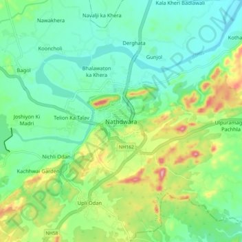
Nom : Carte topographique Nathdwara, altitude, relief.
Altitude moyenne : 590 m
Altitude minimum : 538 m
Altitude maximum : 713 m