
Faire un don
Équipez-vous pour votre prochaine aventure :
En tant que Partenaire Amazon, ce site perçoit une commission sur les achats éligibles sans surcoût pour vous.
Carte topographique Nebelhorn
Cliquez sur la carte pour afficher l’altitude.
Faire un don
Équipez-vous pour votre prochaine aventure :
En tant que Partenaire Amazon, ce site perçoit une commission sur les achats éligibles sans surcoût pour vous.
À propos de cette carte
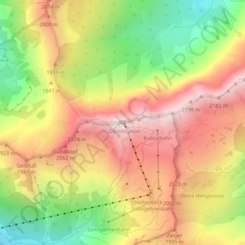
Nom : Carte topographique Nebelhorn, altitude, relief.
Lieu : Nebelhorn, Oberstdorf, Landkreis Oberallgäu, Bavaria, Germany (47.42182 10.34230 47.42192 10.34240)
Altitude moyenne : 1.792 m
Altitude minimum : 1.318 m
Altitude maximum : 2.209 m
Faire un don
Équipez-vous pour votre prochaine aventure :
En tant que Partenaire Amazon, ce site perçoit une commission sur les achats éligibles sans surcoût pour vous.
Autres cartes topographiques
Cliquez sur une carte pour visualiser sa topographie, son altitude et son relief.
Faire un don
Équipez-vous pour votre prochaine aventure :
En tant que Partenaire Amazon, ce site perçoit une commission sur les achats éligibles sans surcoût pour vous.
Holdenried
Germany > Bavaria > Landkreis Oberallgäu > Wiggensbach > Wiggensbach
Altitude moyenne : 904 m
Faire un don
Équipez-vous pour votre prochaine aventure :
En tant que Partenaire Amazon, ce site perçoit une commission sur les achats éligibles sans surcoût pour vous.
Weitnau
Germany > Bavaria > Landkreis Oberallgäu
• Argental Skilifte; Two ski lifts offer well-prepared pistes for beginners and seasoned skiers and snowboarders. The 500-metre-long family lift, a modern T-bar lift with a difference in altitude of 120 metres, was completely rebuilt in the early 2000s. In addition, there is a 100-metre beginners lift with a…
Altitude moyenne : 887 m