
Carte topographique Demerthin
Carte interactive
Cliquez sur la carte pour afficher l’altitude.
À propos de cette carte
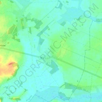
Nom : Carte topographique Demerthin, altitude, relief.
Lieu : Demerthin, Gumtow, Prignitz, Brandenburg, Deutschland (52.95236 12.27371 53.00074 12.32510)
Altitude moyenne : 51 m
Altitude minimum : 41 m
Altitude maximum : 81 m
Autres cartes topographiques
Cliquez sur une carte pour visualiser sa topographie, son altitude et son relief.
Görike
Deutschland > Brandenburg > Gumtow > Görike
Görike, Gumtow, Prignitz, Brandenburg, Deutschland
Altitude moyenne : 56 m
Schloss Demerthin
Deutschland > Brandenburg > Gumtow
Schloss Demerthin, Schulstraße, Demerthin, Gumtow, Prignitz, Brandenburg, 16866, Deutschland
Altitude moyenne : 49 m