
Carte topographique Hamilton County
Carte interactive
Cliquez sur la carte pour afficher l’altitude.
À propos de cette carte
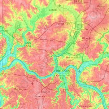
Nom : Carte topographique Hamilton County, altitude, relief.
Lieu : Hamilton County, Ohio, VS (39.02158 -84.82034 39.31208 -84.25640)
Altitude moyenne : 221 m
Altitude minimum : 139 m
Altitude maximum : 306 m
Autres cartes topographiques
Cliquez sur une carte pour visualiser sa topographie, son altitude et son relief.
Cuyahoga Valley National Park
Cuyahoga Valley National Park, Boston, Boston Township, Summit County, Ohio, VS
Altitude moyenne : 308 m