
Carte topographique Daxberg
Cliquez sur la carte pour afficher l’altitude.
À propos de cette carte
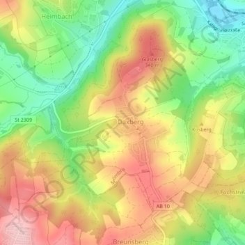
Nom : Carte topographique Daxberg, altitude, relief.
Lieu : Daxberg, Mömbris, Landkreis Aschaffenburg, Bayern, Deutschland (50.03652 9.15187 50.05558 9.18009)
Altitude moyenne : 268 m
Altitude minimum : 170 m
Altitude maximum : 364 m