
Carte topographique Beaumaris
Cliquez sur la carte pour afficher l’altitude.
À propos de cette carte
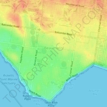
Nom : Carte topographique Beaumaris, altitude, relief.
Altitude moyenne : 19 m
Altitude minimum : 0 m
Altitude maximum : 42 m
Autres cartes topographiques
Cliquez sur une carte pour visualiser sa topographie, son altitude et son relief.
Mount Dandenong
Australia > Victoria > Melbourne
Mount Dandenong has a cool oceanic climate (Cfb), with cool to mild summers and cold, damp winters. Daytime temperatures are usually 4−6 °C cooler than downtown Melbourne due to its elevation and distance from the urban heat island effect of Melbourne. It is significantly cloudier than Melbourne,…
Altitude moyenne : 395 m
Gilbertsons Grassland Nature Conservation Reserve
Australia > Victoria > Melbourne
Altitude moyenne : 36 m
Langwarrin Flora and Fauna Reserve
Australia > Victoria > Melbourne > Langwarrin
Altitude moyenne : 90 m
Narre Warren North Retarding Basin (Melbourne Water)
Australia > Victoria > Melbourne
Altitude moyenne : 76 m