
Carte topographique Klaaswaal
Carte interactive
Cliquez sur la carte pour afficher l’altitude.
À propos de cette carte
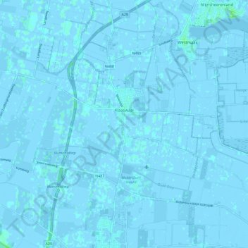
Nom : Carte topographique Klaaswaal, altitude, relief.
Lieu : Klaaswaal, Hoeksche Waard, Südholland, Niederlande (51.74044 4.40469 51.78833 4.51940)
Altitude moyenne : 0 m
Altitude minimum : -4 m
Altitude maximum : 6 m
Autres cartes topographiques
Cliquez sur une carte pour visualiser sa topographie, son altitude et son relief.
Hoeksche Waard
Niederlande > Südholland > Hoeksche Waard
Hoeksche Waard, Südholland, Niederlande
Altitude moyenne : 0 m
Hoeksche Waard
Niederlande > Südholland > Hoeksche Waard
Hoeksche Waard, Südholland, Niederlande
Altitude moyenne : 0 m
's-Gravendeel
Niederlande > Südholland > Hoeksche Waard
's-Gravendeel, Hoeksche Waard, Südholland, Niederlande
Altitude moyenne : 0 m
Strijensas
Niederlande > Südholland > Hoeksche Waard
Strijensas, Hoeksche Waard, Südholland, Niederlande
Altitude moyenne : 0 m
Mijnsheerenland
Niederlande > Südholland > Hoeksche Waard
Mijnsheerenland, Hoeksche Waard, Südholland, Niederlande
Altitude moyenne : 0 m
Strijen
Niederlande > Südholland > Hoeksche Waard
Strijen, Hoeksche Waard, Südholland, Niederlande
Altitude moyenne : -1 m
Goudswaard
Niederlande > Südholland > Hoeksche Waard
Goudswaard, Hoeksche Waard, Südholland, Niederlande
Altitude moyenne : 0 m
Numansdorp
Niederlande > Südholland > Hoeksche Waard
Numansdorp, Hoeksche Waard, Südholland, Niederlande
Altitude moyenne : 0 m