
Carte topographique Pound Ridge
Carte interactive
Cliquez sur la carte pour afficher l’altitude.
À propos de cette carte
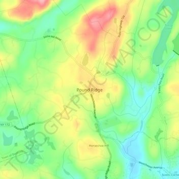
Nom : Carte topographique Pound Ridge, altitude, relief.
Altitude moyenne : 163 m
Altitude minimum : 110 m
Altitude maximum : 232 m
Autres cartes topographiques
Cliquez sur une carte pour visualiser sa topographie, son altitude et son relief.
Sarles Corners
United States of America > New York > Town of Pound Ridge > Pound Ridge > Sarles Corners
Sarles Corners, Pound Ridge, Town of Pound Ridge, Westchester, New York, 10576, United States of America
Altitude moyenne : 141 m