
Carte topographique Arciprestazgo de Alcalá Sur
Carte interactive
Cliquez sur la carte pour afficher l’altitude.
Arciprestazgo de Alcalá Sur
Standing at an average altitude of 654 m, and occupying some 88 km2; the city was for a long time contained in between the Henares to the South and the Madrid-Barcelona railway to the North. However, the increasing population brought on the sprawl of the urbanised area to the area located in between the railway and the A-2 motorway and beyond.
À propos de cette carte
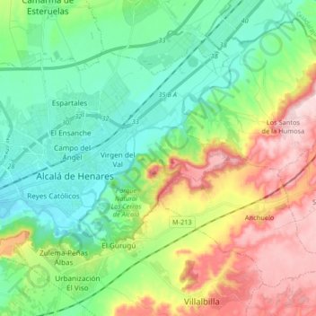
Nom : Carte topographique Arciprestazgo de Alcalá Sur, altitude, relief.
Altitude moyenne : 685 m
Altitude minimum : 576 m
Altitude maximum : 899 m