
Faire un don
Équipez-vous pour votre prochaine aventure :
En tant que Partenaire Amazon, ce site perçoit une commission sur les achats éligibles sans surcoût pour vous.
Carte topographique Kunda
Cliquez sur la carte pour afficher l’altitude.
Faire un don
Équipez-vous pour votre prochaine aventure :
En tant que Partenaire Amazon, ce site perçoit une commission sur les achats éligibles sans surcoût pour vous.
Kunda
Kunda is located at 25°43′N 81°31′E / 25.72°N 81.52°E / 25.72; 81.52. It has an average elevation of 9 metres (291 feet). Kunda is not a very old town and probably was founded during the British Raj. Kunda is Located on Prayagraj-Lucknow National Highway 24B. Place is developing as main commercial location in the region.
Faire un don
Équipez-vous pour votre prochaine aventure :
En tant que Partenaire Amazon, ce site perçoit une commission sur les achats éligibles sans surcoût pour vous.
À propos de cette carte
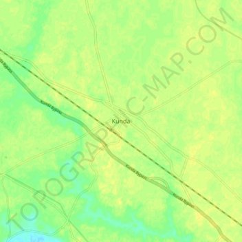
Nom : Carte topographique Kunda, altitude, relief.
Lieu : Kunda, Pratapgarh, Uttar Pradesh, 229406, India (25.67721 81.47370 25.75721 81.55370)
Altitude moyenne : 103 m
Altitude minimum : 91 m
Altitude maximum : 108 m
Faire un don
Équipez-vous pour votre prochaine aventure :
En tant que Partenaire Amazon, ce site perçoit une commission sur les achats éligibles sans surcoût pour vous.
Autres cartes topographiques
Cliquez sur une carte pour visualiser sa topographie, son altitude et son relief.