
Carte topographique Top of the World Provincial Park
Carte interactive
Cliquez sur la carte pour afficher l’altitude.
À propos de cette carte
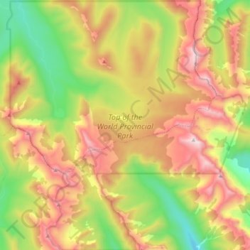
Nom : Carte topographique Top of the World Provincial Park, altitude, relief.
Lieu : Top of the World Provincial Park, Fernie, Canada (49.78815 -115.47874 49.89486 -115.31975)
Altitude moyenne : 2.097 m
Altitude minimum : 1.465 m
Altitude maximum : 2.808 m