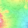
Carte topographique Mount Matutum
Cliquez sur la carte pour afficher l’altitude.
Mount Matutum
Mount Matutum is an active stratovolcano, is the highest point in the province of South Cotabato in the Philippines, with an elevation of 7,500 feet (2,286 metres) above sea level, approximately 5.7 kilometres (3.5 mi) from Acmonan, Tupi, South Cotabato. Matutum and its foothills are predominantly inhabited by the indigenous Blaan families.
À propos de cette carte

Nom : Carte topographique Mount Matutum, altitude, relief.
Altitude moyenne : 1.659 m
Altitude minimum : 1.255 m
Altitude maximum : 2.255 m
Autres cartes topographiques
Cliquez sur une carte pour visualiser sa topographie, son altitude et son relief.