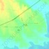
Carte topographique Cooper
Cliquez sur la carte pour afficher l’altitude.
Cooper
Cooper is located at an elevation of 482 ft (147 m), a few miles north of Cooper Lake, between the north and south forks of the Sulphur River. It is located about 76 miles (122 km) northeast of Dallas and 94 miles (151 km) west of Texarkana. Texas State Highway 24 bypasses Cooper to the north; however, Texas State Highway 24 Business splits off and passes through the center of the city. Texas State Highway 154 begins at the western edge of Cooper and passes through the center of the city, intersecting Farm to Market Road 1528 near the county courthouse. Farm to Market Road 64 enters the very western portion of Cooper before terminating at State Highway 24. Nearby highways include Farm to Market Road 1880 and Farm to Market Road 1529.
À propos de cette carte

Nom : Carte topographique Cooper, altitude, relief.
Lieu : Cooper, Delta County, Texas, 75432, United States (33.36208 -95.70866 33.38761 -95.67388)
Altitude moyenne : 144 m
Altitude minimum : 127 m
Altitude maximum : 155 m
Autres cartes topographiques
Cliquez sur une carte pour visualiser sa topographie, son altitude et son relief.