

Faire un don
Équipez-vous pour votre prochaine aventure :
En tant que Partenaire Amazon, ce site perçoit une commission sur les achats éligibles sans surcoût pour vous.
Carte topographique Saltoro Kangri
Cliquez sur la carte pour afficher l’altitude.
Faire un don
Équipez-vous pour votre prochaine aventure :
En tant que Partenaire Amazon, ce site perçoit une commission sur les achats éligibles sans surcoût pour vous.
Saltoro Kangri
The mountain underwent reconnaissance by Fanny Bullock Workman and her husband in 1911-12. The initial endeavor to conquer the peak, which was then denoted as "Peak 36," took place in 1935, led by a British expedition headed by James Waller and John Hunt. Hunt's involvement in the expedition had been suggested by the Himalayan Club in Calcutta. Among the expedition's members were Rowland Brotherhood and Dr. Steward Carslaw, accompanied by two Sherpas named Palden and Dawa Thondup. Their approach to the mountain commenced from the Likah Glacier, with the objective of ascending the South East ridge. They successfully established a final camp on June 19th, yet their altitude estimation proved to be inaccurate. An attempt to reach the summit the following day, amidst worsening weather conditions, was thwarted as they were required to ascend an additional 3500 feet. Hunt and Brotherhood managed to reach an elevation of 24,500 feet but were compelled to turn around.
Faire un don
Équipez-vous pour votre prochaine aventure :
En tant que Partenaire Amazon, ce site perçoit une commission sur les achats éligibles sans surcoût pour vous.
À propos de cette carte
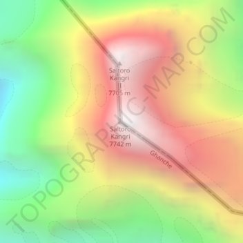
Nom : Carte topographique Saltoro Kangri, altitude, relief.
Altitude moyenne : 6.651 m
Altitude minimum : 5.580 m
Altitude maximum : 7.689 m
Faire un don
Équipez-vous pour votre prochaine aventure :
En tant que Partenaire Amazon, ce site perçoit une commission sur les achats éligibles sans surcoût pour vous.
Autres cartes topographiques
Cliquez sur une carte pour visualiser sa topographie, son altitude et son relief.
