
Carte topographique River Glen
Carte interactive
Cliquez sur la carte pour afficher l’altitude.
À propos de cette carte
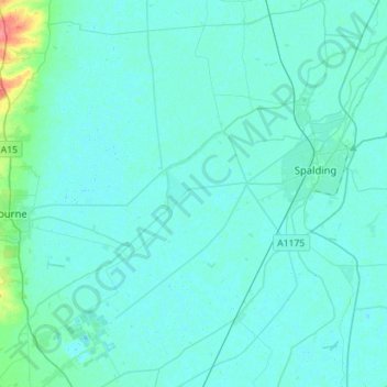
Nom : Carte topographique River Glen, altitude, relief.
Altitude moyenne : 5 m
Altitude minimum : -1 m
Altitude maximum : 53 m
Autres cartes topographiques
Cliquez sur une carte pour visualiser sa topographie, son altitude et son relief.
Donington CP
United Kingdom > England > Lincolnshire > South Holland
Donington CP, South Holland, Lincolnshire, England, United Kingdom
Altitude moyenne : 3 m
Spalding
United Kingdom > England > Lincolnshire > South Holland > Spalding
Spalding, South Holland, Lincolnshire, East Midlands, England, United Kingdom
Altitude moyenne : 4 m
Moulton Chapel
United Kingdom > England > Lincolnshire > South Holland > Moulton Chapel
Moulton Chapel, South Holland, Lincolnshire, East Midlands, England, PE12 0XQ, United Kingdom
Altitude moyenne : 3 m