
Carte topographique Mammoth Lakes
Carte interactive
Cliquez sur la carte pour afficher l’altitude.
Mammoth Lakes
Mammoth Lakes is a town in Mono County, California, the county's only incorporated community. It is located immediately to the east of Mammoth Mountain, at an elevation of 7,880 feet (2,400 m). As of the 2010 United States Census, the population was 8,234, reflecting a 16% increase from the 2000 Census.
À propos de cette carte
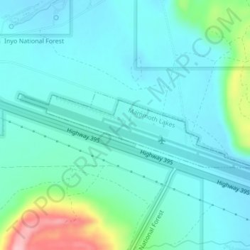
Nom : Carte topographique Mammoth Lakes, altitude, relief.
Altitude moyenne : 2.184 m
Altitude minimum : 2.154 m
Altitude maximum : 2.312 m