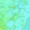
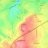
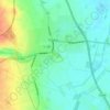
Carte topographique Edlington
Cliquez sur la carte pour afficher l’altitude.
Edlington
Edlington Wood is a 99.7-hectare (246-acre) site located at Grid Ref: SK 549980 an altitude of 45–80 metres some 4 km to the south west of Doncaster; this is the largest single unit of predominantly deciduous woodland on the magnesian limestone in South Yorkshire. It includes large areas of ancient woodland dating from Romano-British times and supports extremely rich plant and animal communities which reflect the site's antiquity, history of forest management, diversity of soil types and moisture conditions. Edlington Wood was designated as a Site of Special Scientific Interest (SSSIS) in 1979.
À propos de cette carte

Nom : Carte topographique Edlington, altitude, relief.
Lieu : Edlington, Doncaster, South Yorkshire, England, United Kingdom (53.45582 -1.20781 53.49087 -1.15807)
Altitude moyenne : 77 m
Altitude minimum : 10 m
Altitude maximum : 146 m
Autres cartes topographiques
Cliquez sur une carte pour visualiser sa topographie, son altitude et son relief.