
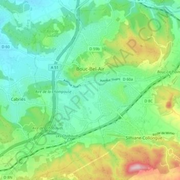
Carte topographique Bouc-Bel-Air
Carte interactive
Cliquez sur la carte pour afficher l’altitude.
À propos de cette carte
Nom : Carte topographique Bouc-Bel-Air, altitude, relief.
Altitude moyenne : 227 m
Altitude minimum : 136 m
Altitude maximum : 440 m
Autres cartes topographiques
Cliquez sur une carte pour visualiser sa topographie, son altitude et son relief.
Marseille
France > Provence-Alpes-Côte d'Azur > Bouches-du-Rhône
Marseille, Bouches-du-Rhône, Provence-Alpes-Côte d'Azur, Metropolitan France, 13000, France
Altitude moyenne : 94 m
13760
France > Provence-Alpes-Côte d'Azur > Bouches-du-Rhône > Saint-Cannat
13760, Saint-Cannat, Aix-en-Provence, Bouches-du-Rhône, Provence-Alpes-Côte d'Azur, Metropolitan France, France
Altitude moyenne : 241 m
Fos-sur-Mer
France > Provence-Alpes-Côte d'Azur > Bouches-du-Rhône
Fos-sur-Mer, Istres, Bouches-du-Rhône, Provence-Alpes-Côte d'Azur, Metropolitan France, 13270, France
Altitude moyenne : 10 m
13820
France > Provence-Alpes-Côte d'Azur > Bouches-du-Rhône > Ensuès-la-Redonne > Les Coulins
13820, Les Coulins, Ensuès-la-Redonne, Istres, Bouches-du-Rhône, Provence-Alpes-Côte d'Azur, Metropolitan France, France
Altitude moyenne : 115 m
Marignane
France > Provence-Alpes-Côte d'Azur > Bouches-du-Rhône
Marignane, Istres, Bouches-du-Rhône, Provence-Alpes-Côte d'Azur, Metropolitan France, 13700, France
Altitude moyenne : 24 m
Le Puy-Sainte-Réparade
France > Provence-Alpes-Côte d'Azur > Bouches-du-Rhône
Le Puy-Sainte-Réparade, Aix-en-Provence, Bouches-du-Rhône, Provence-Alpes-Côte d'Azur, Metropolitan France, 13610, France
Altitude moyenne : 273 m
Parc national des Calanques (cœur)
France > Provence-Alpes-Côte d'Azur > Bouches-du-Rhône
Parc national des Calanques (cœur), Bouches-du-Rhône, Provence-Alpes-Côte d'Azur, Metropolitan France, France
Altitude moyenne : 41 m
Châteaurenard
France > Provence-Alpes-Côte d'Azur > Bouches-du-Rhône
Châteaurenard, Arles, Bouches-du-Rhône, Provence-Alpes-Côte d'Azur, Metropolitan France, 13160, France
Altitude moyenne : 37 m
Aix-en-Provence
France > Provence-Alpes-Côte d'Azur > Bouches-du-Rhône
Aix-en-Provence, Bouches-du-Rhône, Provence-Alpes-Côte d'Azur, Metropolitan France, France
Altitude moyenne : 270 m
Fontvieille
France > Provence-Alpes-Côte d'Azur > Bouches-du-Rhône
Fontvieille, Arles, Bouches-du-Rhône, Provence-Alpes-Côte d'Azur, Metropolitan France, 13990, France
Altitude moyenne : 38 m
Miramas
France > Provence-Alpes-Côte d'Azur > Bouches-du-Rhône
Miramas, Istres, Bouches-du-Rhône, Provence-Alpes-Côte d'Azur, Metropolitan France, 13140, France
Altitude moyenne : 53 m
La Cride
France > Provence-Alpes-Côte d'Azur > Bouches-du-Rhône > Le Puy-Sainte-Réparade
La Cride, Le Puy-Sainte-Réparade, Aix-en-Provence, Bouches-du-Rhône, Provence-Alpes-Côte d'Azur, Metropolitan France, 13610, France
Altitude moyenne : 304 m
Trets
France > Provence-Alpes-Côte d'Azur > Bouches-du-Rhône
Trets, Aix-en-Provence, Bouches-du-Rhône, Provence-Alpes-Côte d'Azur, Metropolitan France, 13530, France
Altitude moyenne : 349 m
Lambesc
France > Provence-Alpes-Côte d'Azur > Bouches-du-Rhône
Lambesc, Aix-en-Provence, Bouches-du-Rhône, Provence-Alpes-Côte d'Azur, Metropolitan France, 13410, France
Altitude moyenne : 233 m
Les Pennes-Mirabeau
France > Provence-Alpes-Côte d'Azur > Bouches-du-Rhône
Les Pennes-Mirabeau, Aix-en-Provence, Bouches-du-Rhône, Provence-Alpes-Côte d'Azur, Metropolitan France, 13170, France
Altitude moyenne : 162 m
Saint-Martin-de-Crau
France > Provence-Alpes-Côte d'Azur > Bouches-du-Rhône
Saint-Martin-de-Crau, Arles, Bouches-du-Rhône, Provence-Alpes-Côte d'Azur, Metropolitan France, 13310, France
Altitude moyenne : 24 m
5th Arrondissement
France > Provence-Alpes-Côte d'Azur > Bouches-du-Rhône > Marseille
5th Arrondissement, Marseille, Bouches-du-Rhône, Provence-Alpes-Côte d'Azur, Metropolitan France, 13005, France
Altitude moyenne : 43 m
Rognac
France > Provence-Alpes-Côte d'Azur > Bouches-du-Rhône
Rognac, Istres, Bouches-du-Rhône, Provence-Alpes-Côte d'Azur, Metropolitan France, 13340, France
Altitude moyenne : 79 m
Cazan
France > Provence-Alpes-Côte d'Azur > Bouches-du-Rhône > Vernègues
Cazan, Vernègues, Aix-en-Provence, Bouches-du-Rhône, Provence-Alpes-Côte d'Azur, Metropolitan France, 13116, France
Altitude moyenne : 219 m
Eygalières
France > Provence-Alpes-Côte d'Azur > Bouches-du-Rhône
Eygalières, Arles, Bouches-du-Rhône, Provence-Alpes-Côte d'Azur, Metropolitan France, 13810, France
Altitude moyenne : 142 m
Salon de Provence
France > Provence-Alpes-Côte d'Azur > Bouches-du-Rhône
Salon de Provence, Aix-en-Provence, Bouches-du-Rhône, Provence-Alpes-Côte d'Azur, Metropolitan France, 13300, France
Altitude moyenne : 119 m
Aubagne
France > Provence-Alpes-Côte d'Azur > Bouches-du-Rhône
Aubagne, Marseille, Bouches-du-Rhône, Provence-Alpes-Côte d'Azur, Metropolitan France, 13400, France
Altitude moyenne : 219 m
Vitrolles
France > Provence-Alpes-Côte d'Azur > Bouches-du-Rhône
Vitrolles, Istres, Bouches-du-Rhône, Provence-Alpes-Côte d'Azur, Metropolitan France, 13127, France
Altitude moyenne : 80 m
Arles
France > Provence-Alpes-Côte d'Azur > Bouches-du-Rhône
Arles, Bouches-du-Rhône, Provence-Alpes-Côte d'Azur, Metropolitan France, France
Altitude moyenne : 13 m
Venelles
France > Provence-Alpes-Côte d'Azur > Bouches-du-Rhône
Venelles, Aix-en-Provence, Bouches-du-Rhône, Provence-Alpes-Côte d'Azur, Metropolitan France, 13770, France
Altitude moyenne : 349 m
Aix-en-Provence
France > Provence-Alpes-Côte d'Azur > Bouches-du-Rhône > Aix-en-Provence
Aix-en-Provence, Bouches-du-Rhône, Provence-Alpes-Côte d'Azur, Metropolitan France, 13626, France
Altitude moyenne : 279 m
Arles
France > Provence-Alpes-Côte d'Azur > Bouches-du-Rhône > Arles > Arles
Arles, Bouches-du-Rhône, Provence-Alpes-Côte d'Azur, Metropolitan France, 13200, France
Altitude moyenne : 7 m
Saint-Rémy-de-Provence
France > Provence-Alpes-Côte d'Azur > Bouches-du-Rhône
Saint-Rémy-de-Provence, Arles, Bouches-du-Rhône, Provence-Alpes-Côte d'Azur, Metropolitan France, 13210, France
Altitude moyenne : 100 m
Auriol
France > Provence-Alpes-Côte d'Azur > Bouches-du-Rhône
Auriol, Marseille, Bouches-du-Rhône, Provence-Alpes-Côte d'Azur, Metropolitan France, 13390, France
Altitude moyenne : 337 m
Tarascon
France > Provence-Alpes-Côte d'Azur > Bouches-du-Rhône
Tarascon, Arles, Bouches-du-Rhône, Provence-Alpes-Côte d'Azur, Metropolitan France, 13150, France
Altitude moyenne : 26 m
Rognes
France > Provence-Alpes-Côte d'Azur > Bouches-du-Rhône > Rognes
Rognes, Aix-en-Provence, Bouches-du-Rhône, Provence-Alpes-Côte d'Azur, Metropolitan France, 13840, France
Altitude moyenne : 293 m
Tête de Chien
France > Provence-Alpes-Côte d'Azur > Bouches-du-Rhône > Auriol
Tête de Chien, Auriol, Marseille, Bouches-du-Rhône, Provence-Alpes-Côte d'Azur, Metropolitan France, 13390, France
Altitude moyenne : 473 m
La Ciotat
France > Provence-Alpes-Côte d'Azur > Bouches-du-Rhône
La Ciotat, Marseille, Bouches-du-Rhône, Provence-Alpes-Côte d'Azur, Metropolitan France, 13600, France
Altitude moyenne : 89 m
Aurons
France > Provence-Alpes-Côte d'Azur > Bouches-du-Rhône > Aurons
Aurons, Aix-en-Provence, Bouches-du-Rhône, Provence-Alpes-Côte d'Azur, Metropolitan France, 13121, France
Altitude moyenne : 245 m
Berre-l'Étang
France > Provence-Alpes-Côte d'Azur > Bouches-du-Rhône
Berre-l'Étang, Istres, Bouches-du-Rhône, Provence-Alpes-Côte d'Azur, Metropolitan France, 13130, France
Altitude moyenne : 38 m