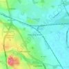
Carte topographique Sykehouse
Cliquez sur la carte pour afficher l’altitude.
Sykehouse
The village of Sykehouse contains the parish church of the Holy Trinity. Most of this grade II listed building was built in 1869 by C. H. Fowler, using red bricks and a Gothic Revival style. The tower is older, having been built in 1721, while the font is fifteenth century, but this is presumed to have come from elsewhere. Other listed buildings include a red-brick and rubble barn, attached to Marsh Hills Farmhouse, and the farmhouse itself, which is early eighteenth century with twentieth century alterations. Sykehouse also contains the Village Hall where numerous meetings are held; including: the Parish Council, Show Committee, Women's Institute, Cricket Club and the Parochial Church Council. The village is located at approximately 53° 38' 30" North, 1° 3' West, at an elevation of around 4 metres above sea level.
À propos de cette carte

Nom : Carte topographique Sykehouse, altitude, relief.
Lieu : Sykehouse, Doncaster, South Yorkshire, England, United Kingdom (53.62932 -1.08150 53.66120 -0.98406)
Altitude moyenne : 6 m
Altitude minimum : 0 m
Altitude maximum : 12 m
Autres cartes topographiques
Cliquez sur une carte pour visualiser sa topographie, son altitude et son relief.