
Carte topographique Sundargarh
Carte interactive
Cliquez sur la carte pour afficher l’altitude.
À propos de cette carte
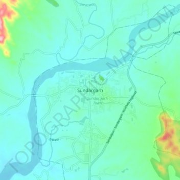
Nom : Carte topographique Sundargarh, altitude, relief.
Altitude moyenne : 243 m
Altitude minimum : 214 m
Altitude maximum : 400 m
Sundargarh is located at 22°07′N 84°02′E / 22.12°N 84.03°E / 22.12; 84.03. It has an average elevation of 243 metres (801 feet). The Ib river flows along in the north.