
Carte topographique Rendon
Cliquez sur la carte pour afficher l’altitude.
À propos de cette carte
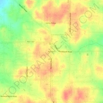
Nom : Carte topographique Rendon, altitude, relief.
Lieu : Rendon, Fort Worth, Tarrant County, Texas, United States (32.55625 -97.26140 32.59625 -97.22140)
Altitude moyenne : 221 m
Altitude minimum : 189 m
Altitude maximum : 240 m
Autres cartes topographiques
Cliquez sur une carte pour visualiser sa topographie, son altitude et son relief.
Benbrook Lake
United States > Texas > Tarrant County > Fort Worth
Construction of Benbrook dam began in May 1947, and was practically completed when floodgates were closed and deliberate impoundment was begun in September 1952. The cost to build the lake was $14.5 million ($112 million in 2007 dollars). The rolled-earth embankment is 9,130 feet (2,783 m) in length, including…
Altitude moyenne : 228 m
Will Rogers Memorial Center
United States > Texas > Tarrant County > Fort Worth
Altitude moyenne : 181 m