
Carte topographique Rungwe
Carte interactive
Cliquez sur la carte pour afficher l’altitude.
À propos de cette carte
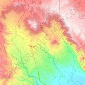
Nom : Carte topographique Rungwe, altitude, relief.
Lieu : Rungwe, Mbeya, Southern Highlands Zone, Tanzanie (-9.50949 33.43816 -8.95793 33.99059)
Altitude moyenne : 1.590 m
Altitude minimum : 474 m
Altitude maximum : 2.929 m
Autres cartes topographiques
Cliquez sur une carte pour visualiser sa topographie, son altitude et son relief.