Géolocaliser

Carte topographique Cobija

Carte interactive

Cliquez sur la carte pour afficher l’altitude.

À propos de cette carte

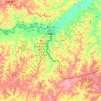
Nom : Carte topographique Cobija, altitude, relief.

Lieu : Cobija, Nicolás Suárez, Pando, 69932-000, Bolivia (-11.14476 -69.00024 -10.98738 -68.71154)

Altitude moyenne : 237 m

Altitude minimum : 175 m

Altitude maximum : 303 m

Cobija is a city in Bolivia, capital of the department of Pando, is located about 600 km (373 mi.) north of La Paz in the Amazon Basin on the border with Brazil. Cobija lies on the banks of the Rio Acre across from the Brazilian city of Brasiléia. Cobija lies at an elevation of ca. 280 m (920 ft.) above sea level and has a tropical and rainy climate.

Wikipedia (CC-BY-SA 3.0)