
Carte topographique Cervin
Carte interactive
Cliquez sur la carte pour afficher l’altitude.
Cervin
Le Cervin (en allemand : Matterhorn, en italien : Cervino) est, par son altitude de 4 478 mètres, le 12e sommet des Alpes. Il est situé sur la frontière italo-suisse, entre le canton du Valais et la Vallée d'Aoste. Il donne sur la ville suisse de Zermatt au nord-est et la ville italienne de Breuil-Cervinia au sud. Il relie la vallée de Zermatt et le Valtournenche, en Vallée d'Aoste, par le col de Saint-Théodule, à l’est.
À propos de cette carte
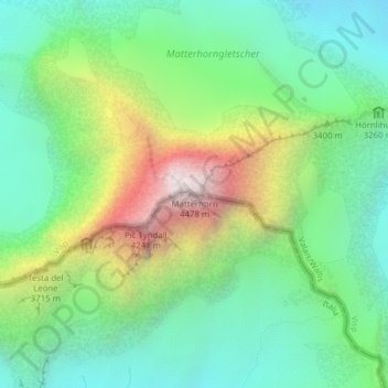
Nom : Carte topographique Cervin, altitude, relief.
Lieu : Cervin, Valtournenche, Vallée d'Aoste, Italie (45.97638 7.65855 45.97648 7.65865)
Altitude moyenne : 3.295 m
Altitude minimum : 2.762 m
Altitude maximum : 4.389 m