
Carte topographique Cathair na Gaillimhe
Carte interactive
Cliquez sur la carte pour afficher l’altitude.
À propos de cette carte
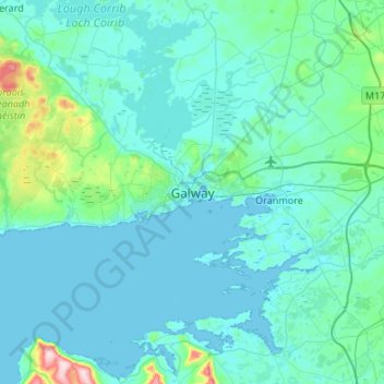
Nom : Carte topographique Cathair na Gaillimhe, altitude, relief.
Altitude moyenne : 26 m
Altitude minimum : -4 m
Altitude maximum : 312 m
Autres cartes topographiques
Cliquez sur une carte pour visualiser sa topographie, son altitude et son relief.
Rahoon
Irlande > Cathair na Gaillimhe > Galway Municipal District
Rahoon, Galway Municipal District, Cathair na Gaillimhe, County Galway, Connacht, Irlande
Altitude moyenne : 42 m