
Carte topographique Jos
Carte interactive
Cliquez sur la carte pour afficher l’altitude.
Jos
Jos est la capitale de l'État de Plateau, au centre du Nigeria. Située sur le plateau de Jos à près de 1 300 mètres d'altitude, elle jouit d'un climat plus tempéré que le reste du pays avec des températures moyennes comprises entre 21 et 25°.
À propos de cette carte
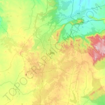
Nom : Carte topographique Jos, altitude, relief.
Lieu : Jos, Jos North, État de Plateau, 903105, Nigéria (9.75751 8.73794 10.07751 9.05794)
Altitude moyenne : 1.181 m
Altitude minimum : 847 m
Altitude maximum : 1.758 m